Build a GTA in your town in 30 minutes
Import real OpenStreetMap data into your game engine. Get 3D buildings, streets, water, trees, terrain, and full game systems — no modeling required.
Import real OpenStreetMap data into your game engine. Get 3D buildings, streets, water, trees, terrain, and full game systems — no modeling required.
From OSM data to playable game — buildings, streets, water, terrain, weather, NPCs, vehicles, and more.
Correct heights from OSM tags, 10 roof shapes, wall colors from building:colour/material tags, windows, balconies, and building parts for landmarks.
Round oaks, columnar poplars, weeping willows, spreading plane trees, palm trees, cone pines, and more. Species inferred from OSM genus tags.
Real-world elevation data from OpenTopoData. Gaussian-smoothed terrain mesh with roads and buildings that follow the terrain surface.
Vertex-displaced waves with fresnel reflections, sun sparkle, and shimmer. Stencil-based rendering ensures water is always visible.
Realistic sun position from geographic coordinates. Sunrise/sunset sky colors, street lamp glow halos, lit windows, vehicle headlights and taillights.
Clear, cloudy, light rain, heavy rain, storm with lightning, fog, and snow. Rain particles, wet street reflections, dynamic fog, and thunder audio.
5 procedural vehicle types. Arcade driving physics. AI traffic with road-type speed limits, obstacle avoidance, and intersection stops.
Procedural humanoid models with random appearance. Walk between destinations via A* pathfinding. Flee from approaching vehicles. LOD system.
Default realistic, Illustrated/Parisian with mansard roofs, Neon Cyberpunk with glow strips, and Pencil Drawing with edge detection and cross-hatching.
Pick a template and start playing immediately, or create your own. Full game systems are created automatically.
GTA-style: walk, drive, explore. Vehicles, NPCs, traffic, day/night cycle, weather, ambient audio.
Draw a route on the map, race with checkpoints and timer. AI opponent with speed variation and turn braking.
Explore the city on foot. Building info popups when nearby. Photo mode with free camera (P key).
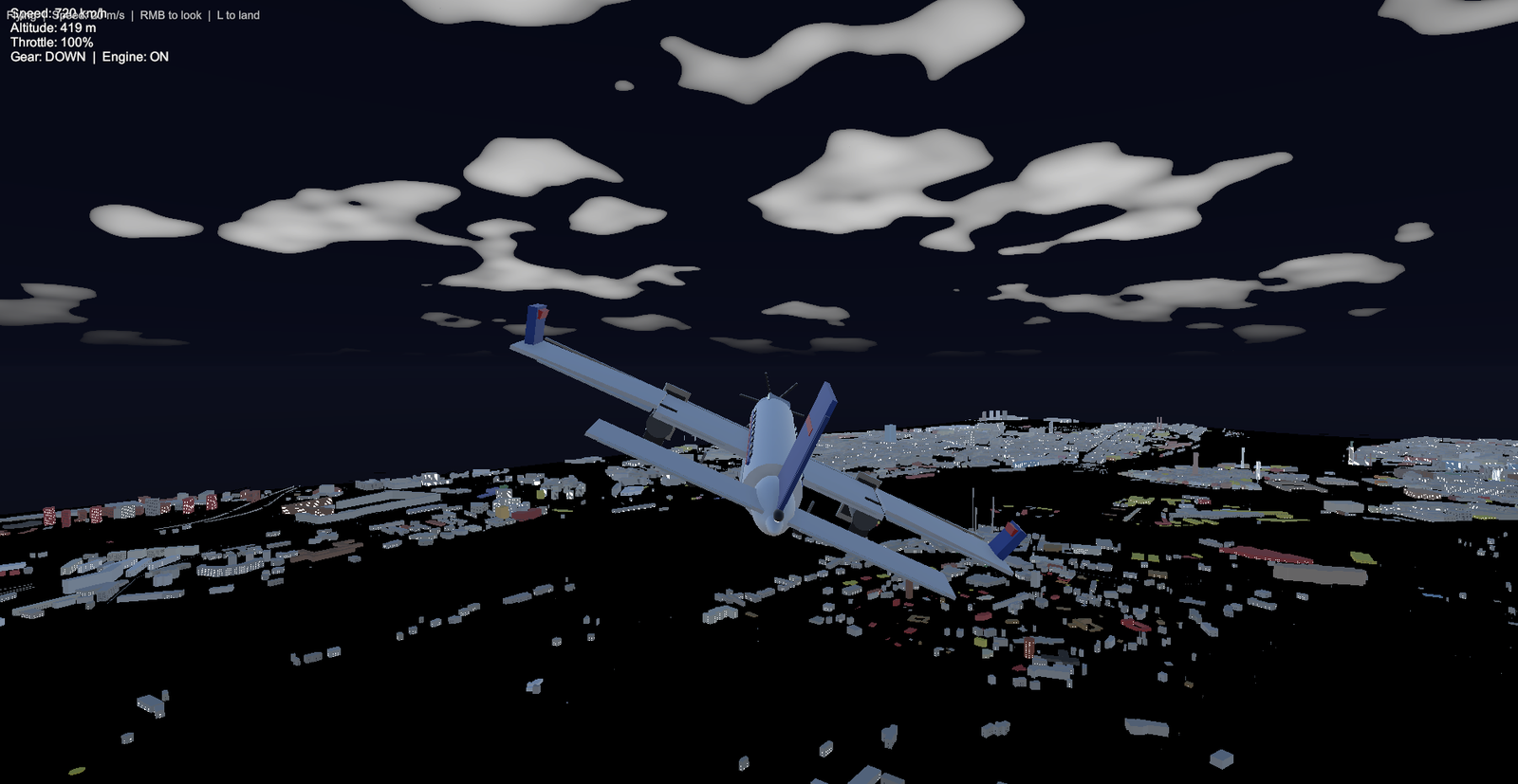
Arcade flight over the city. Cockpit view (V key), auto-leveling, throttle control. Terrain-following ground height.
Full runtime API for building custom game logic on top of the imported city.
Query buildings, find paths, generate spawn points, detect zones, and convert coordinates — all at 60fps.
// Find the nearest restaurant
var city = OsmCity.Instance;
city.BuildSpatialIndex();

var results = new List<SpatialQueryResult>();
city.SpatialIndex.FindByTag(
    "amenity", "restaurant", results);

// Navigate to it
city.BuildStreetGraph();
var path = city.StreetGraph.FindPath(
    player.position, results[0].WorldPosition);

Debug.Log($"Distance: {path.TotalLength:F0}m");

// Spawn NPCs on sidewalks
var spawn = OsmSpawnUtility
    .GetRandomSidewalkSpawn(city);
Instantiate(npcPrefab, spawn.Position, spawn.Rotation);
Same city data, multiple game engines.
Full-featured plugin with URP rendering, editor window with map preview, 4 game modes, visual styles, and complete runtime API. Production ready.
Editor plugin and standalone app. Buildings, streets, water, trees, terrain with custom shaders. Day/night cycle, weather, player controller. Also available as a standalone app on Steam.
Command-line tool for batch processing. Import cities, export to OBJ and Minecraft Java Edition. Useful for automation, CI/CD pipelines, and headless servers.
No API keys required. Import any city in the world from OpenStreetMap data.